Searching for the landscape of a lost culture in the ancient swamps and wetlands of the Mississippi Delta.
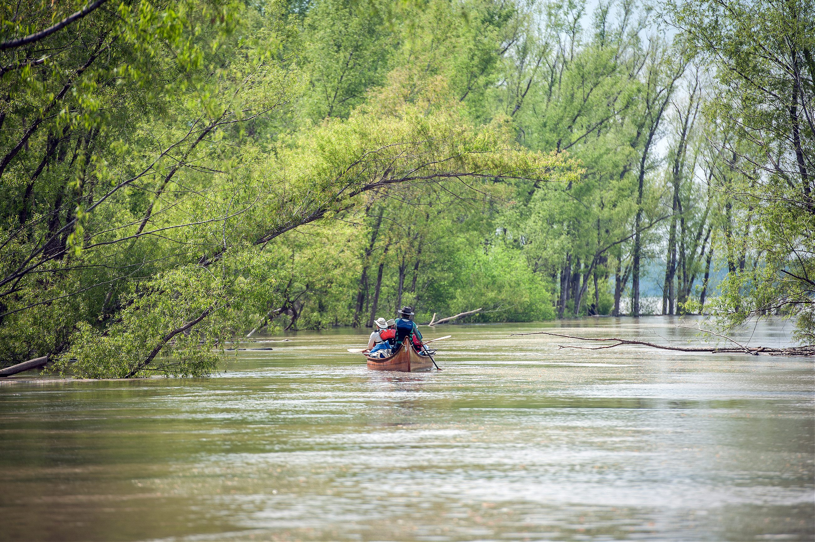
As soon as we paddled out of Memphis, everything turned green. I had been told it would be like this—wild and quiet and verdant—but still, I was surprised. I thought I knew the local geography; after all, I’ve been driving up and down the nearby stretch of Highway 61 for more than eight years. But when you’re accustomed to tawdry highway gas stations and strip malls, it’s hard to imagine that this kind of quiet, undisciplined greenery persists.
I had been looking forward to our arrival here, in the river’s wildest wetlands, with what many would consider a strange eagerness. Americans, after all, have never much liked wetlands. Drain the swamps, we say, a political battle cry but also an economic imperative; our homes and farms and national landmarks are built atop the wetlands of yesteryear. Soon, legal changes may make it easier to drain swamps than it has been for years. But the stretch of the Mississippi River we were entering has managed to persist in its swampy state for centuries.
For two hundred miles heading downstream from Memphis, the land on the east side of the river is known as the Mississippi Delta: an almond-shaped flatland famous for its historic cotton crop. I moved to the Delta eight years ago for a job that I’ve since left, and I stayed in part because I’m entranced by its rural beauty: long, straight highways and sunsets over its perfectly flat fields. Eventually, though, I developed a creeping sense of lack. Nothing here is wild. Lush and vegetative, sure, but these farms are heavily engineered.
On the margins of the farms, though, there are hints of something else. The bayous are overrun with trees and vines; rainfall catches in small depressions, turning them back to swamps. You can see that this land was carved by the river, and still holds a bit of the river’s wild. Little more than a century ago, in fact, the swamps here were considered impenetrable, famous for their panthers and bears.
This ghost landscape persists most stubbornly along the riverside, where, beyond the levee that keeps the farms and townships dry, there are miles of woods. The “Big Woods,” William Faulkner called them. These are the leftovers, after all our development. I call this the walled-in wild.
For almost a year now I’ve been researching a book about the river and these swamps, and early on I decided to join this canoe expedition: six weeks from St. Louis to the Gulf of Mexico. Then, just after I committed to the trip, my father passed away. He was a scientist and an environmentalist, and a traveler, too. He was my first guide, leading me out into the wild world. Suddenly, this canoe trip became something different. I thought of it as a grand act I could dedicate to him, my best attempt to match the voyages he made as a young man. It was a retreat into a more innocent landscape, where I could mourn a man who loved the woods.
So it was lovely to arrive that afternoon on Cat Island, the first campsite our expedition reached after arriving in the Delta. We landed the canoe onto a long, narrow shelf of sand; above us unfurled a meadow, and between beach and grass tall sycamores stood guard. The air was heavy with smell of drying grass. The bridges and industry of Memphis were forgotten, and I sat on a log by the riverside, eating a dinner of catfish smoked in branches pulled from the island’s willow trees.
This river was once the heart of Native America. Before the arrival of Europeans, there were people living everywhere on the North American continent, but the Mississippi and its swamps produced one of the richest and longest-standing cultures in our prehistory.
Today we call that cultural tradition “Mississippian,” and it’s marked by a few common traits: corn-growing villagers who built rectangular mounds around open plazas; artifacts whose designs feature a particular set of motifs. It’s a culture that spanned centuries—beginning 1,200 years ago and lasting for roughly four centuries—and spread across a wide geographic region. The diversity within that label—linguistic, ethnic, and tribal—is, while impossible to verify archaeologically, almost certainly vast. (Indeed, given this breadth, some archaeologists have suggested dropping “Mississippian” as a label, though its use remains common.) One commonality, as I see it: these were people of the swamp.
For many millennia, the Mississippi River was one of the world’s great swamps. It’s lower thousand miles spread wide across a floodplain, 35,000 square miles of muddy almost-soil, one of the largest wetlands in the world. In these slow and flood-fed waters, life flourished: fish and algae fed birds and otters, which fed panthers and wolves and bears in turn. Now, it’s mostly gone. In the three centuries that Europeans and their descendants have farmed this riverside, its floodplain has been reduced by 90 percent.


Mississippi villages and cities were built amid the wetlands. The largest and most important of these cities is known as Cahokia; it sat across from modern St. Louis, amid shallow lakes and fragrant mudflats. The residents of Winterville, a later site (and the preeminent example of Mississippian mounds within the Mississippi Delta), would travel almost exclusively by dugout canoe, so wet was the surrounding land.
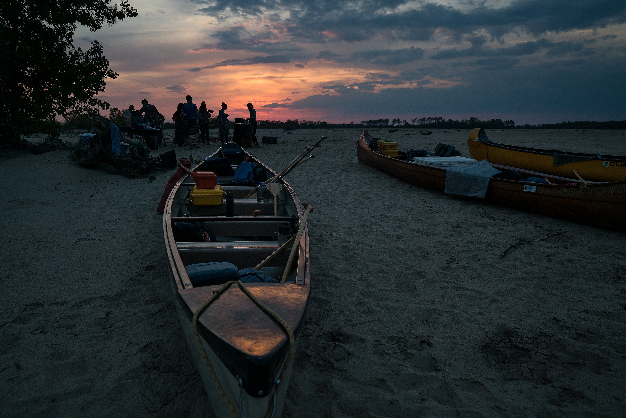
That’s unlikely to sound appealing to most Americans. But our campsites in the Delta made the virtues of that landscape clear. On Buck Island, for example, one of just five publicly owned islands on the Lower Mississippi, we tucked into a backchannel, a narrow stream that divided an open sandbar on one side from thick, seething woods. We carried our gear up the sandbar and pitched our tents in a dense stand of young willows. These sorts of places, on the river or anywhere else, always remind me of my father. My first pieces of camping gear were his hand-me-downs, rugged old equipment that he passed on once he knew he would no longer camp. It was his stories of adventure that made me a traveler—he once walked across Afghanistan—and, a few weeks before his death, as the coming end became clear, the hardest thing for me to swallow was that I would not get to tell him mine.
We had plenty of company, just little that was human
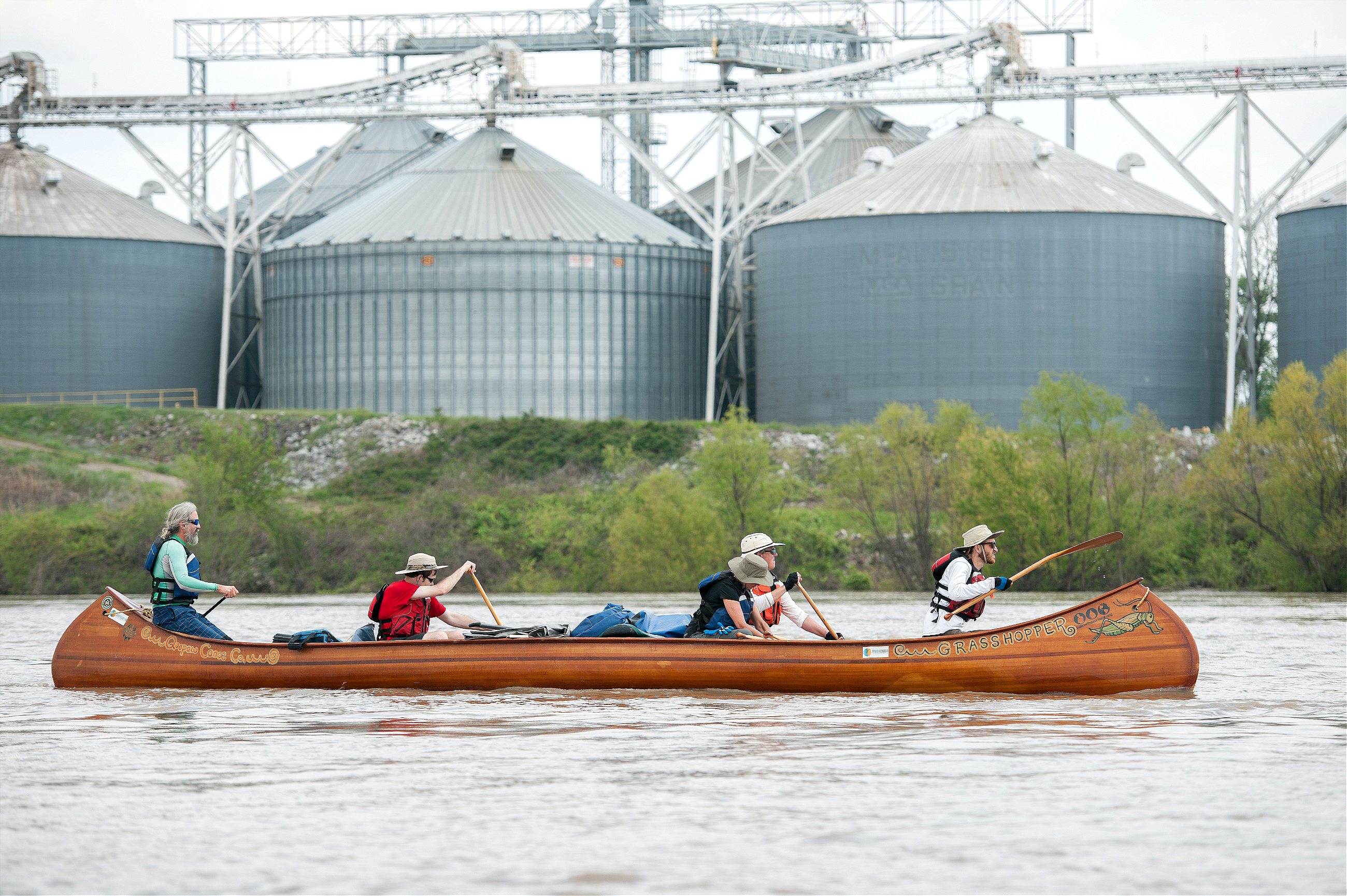
The expedition was planned by John Ruskey, the founder of the Quapaw Canoe Company and the Lower Mississippi River Foundation. Ruskey has spent six years compiling a guide to paddling the river’s wilderness; Rivergator, as it’s titled, was completed last year. The trip was meant to celebrate that accomplishment, and spread the word: there are more than a thousand miles of free-flowing water between the confluence of the Missouri and the Gulf of Mexico, water that is open and available to recreational paddlers. (Disclosure: the Lower Mississippi River Foundation helped fund the research for this and other stories of mine.)
The river above and below the Delta is beautiful, but it’s clustered with big-city ports and chemical refineries. Industrial barges often line the banks. Through the Delta, meanwhile, there is just one bridge in two hundred miles, and a few bankside cabins clustered among the endless willow trees: this, Ruskey writes in Rivergator, is the “hardest-to-get-to section of river with the most remote islands and wildest stretches of woods” below the headwaters.
Indeed: for days, we had little company besides the occasional towboat, and, on a Saturday, casual pairs of fishermen parked in flat corners of the river. Or, really, we had plenty of company, just little that was human. On Choctaw Island, we found a quartet of speckled black-and-white tern eggs, proof that a once-endangered species was on the return. Almost every night we heard the gurgling howls of coyotes, the splash of deer jumping, the slap of beaver tails against the water. In many ways, it looks little different than when ancient Mississippian priests were paddling through.
The most visible evidence of this culture in the Delta are the Indian mounds that pop up in its fields, the sole bit of altitude across miles of flat ground. According to one state document, these together constitute one of “the highest concentrations of prehistoric archaeological sites in the world.”
Faulkner wrote about these mounds. In one story, two boys camp atop a mound, and then leave in the morning without saying a word, such is the depth of their awe. The mounds leave me silent, too, though to be honest mine is the silence of the underwhelmed. They are dirt piles. They sit there, low and meager: paltry monuments that undersell their past. The first archaeologists to visit them were disappointed, too, by the few artifacts they found.
There have been mound-builders in the region for many thousands of years; the first pyramids in the Americas were built along the back waterways of the Mississippi River in Louisiana around 3,500 B.C. The great earthwork ridges at Poverty Point, in Louisiana—a UNESCO World Heritage Site—were the product of five million hours of labor, all conducted 3,000 years ago, before agriculture began to flourish in the valley. That’s an accomplishment almost unheard of; typically, such massive labor must be fueled by the surplus foodstuffs of farming. But the river created conditions favorable for good living: gar and catfish swimming in the river’s backwaters; nuts and berries growing on the high grounds; turkey and swamp rabbits running through the woods.


Even a thousand years ago, it was from these swamps that the residents of the Mississippi Delta fed themselves; besides a minor bit of slash-and-burn corn farming, the people here then were largely hunters and gatherers. The Coles Creek people, as this culture is now known, built mounds, too, though these were relatively small and rarely occupied, serving as sites for occasional feasts and funerals.
The Coles Creek culture was centered in the southern Delta, and its northernmost outpost was a village just north of today’s Greenville, Mississippi. At this site, early in the second millennium, new forms of pottery begin to appear: tempered with crushed mussel shells, it was stronger and therefore larger and able to be used in many new ways.
Bigger changes were on the way: by 1200 A.D., more and more cultural practices were trickling in from the north. The once-small village became a massive mound site, one of the largest in the Southeast. Winterville—as we call it now—and its rise suggests a level of strategic coordination: sitting at the nexus of waterways, it allowed for military control of the surrounding lands.
The Mississippi has a particular ability to create
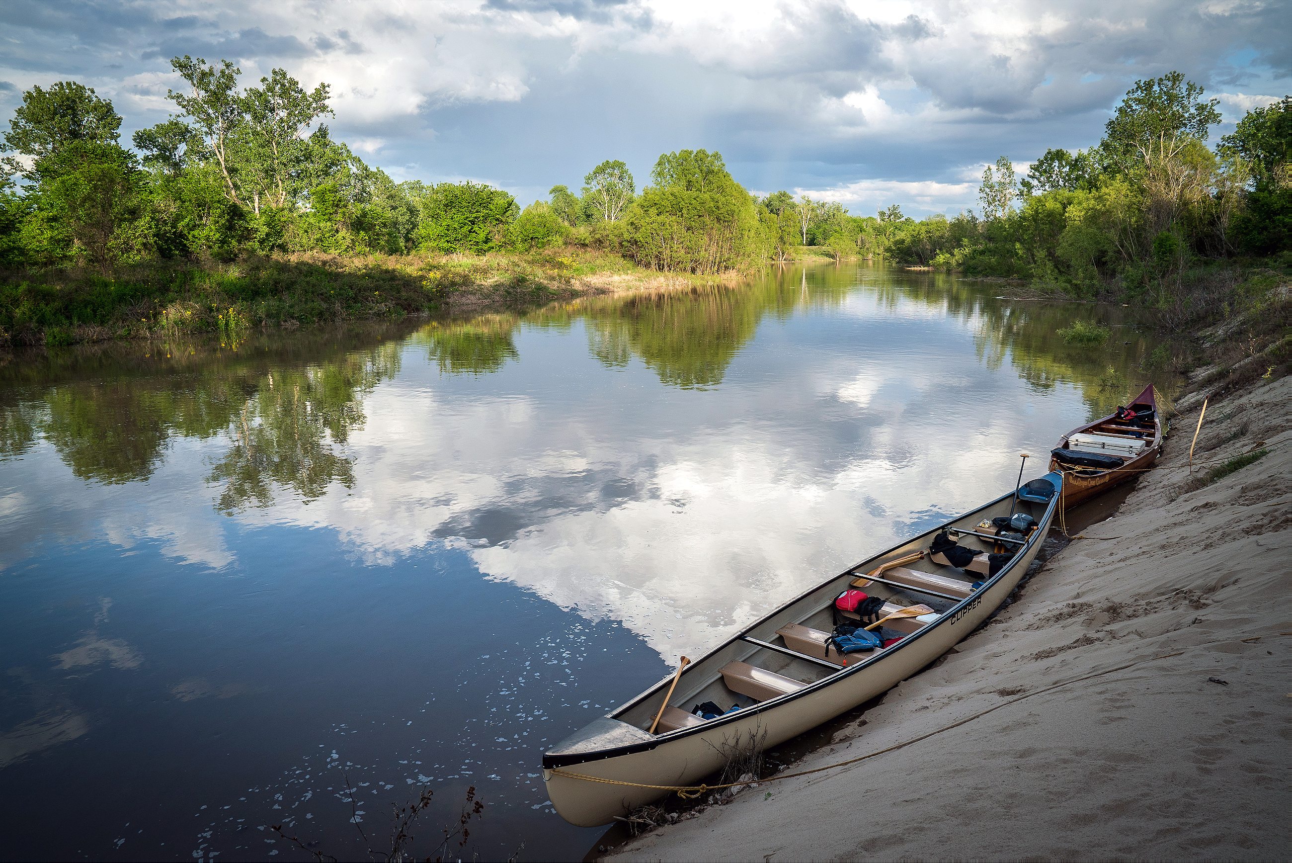
The pages of my journal include notes on cutbanks and sandbars, beautifully sculpted by the wind and water, and on the young willow forests growing up amid brand-new islands. Creation, I began to see, was not a one-time occurrence, but something that happens again and again. We camped on one island that did not appear on the U.S. Army Corps’ 2011 navigation maps, the latest editions. It had been built since, by mud and sand deposited here. I walked its perimeter: it was probably two miles around, topped with a thick forest of willows.
Such is the power of water: it carves through dirt, eroding the land; but then it carries that dirt, and builds new land somewhere else. And the Mississippi, famous for its thick muddiness, has a particular ability to create. The landscape of the Lower Mississippi River is almost entirely river-built, the same process writ over thousands of years.
Those soils also supported the biodiversity that fed the Coles Creek villagers. But further upriver, in the small, corn-farming village that would become Cahokia, it fed a different kind of life. There, farmers discovered that the soil carried from across the continent was particularly rich; while not yet using fertilizer, these farmers found they could grow massive quantities of corn.
This turn to intensive corn agriculture marks the beginning of Mississippian culture. Around 1050 A.D., the city of Cahokia grew rapidly. Dozens of pyramids were engineered; 16,000 people lived within a one square-mile city, with tens of thousands more occupying outlying farms. From this city, Mississippian culture spread outwards, to the Mississippi Delta and beyond.
By necessity, Mississippian people lived in concert with the river: they lived on natural levees that rarely flooded; their farms in the lowlands, meanwhile, received annual deposits of fresh, flood-carried soil. A balanced relationship with nature seems apparent from their cosmology, which has been roughly gleaned from the figures adorning their pottery. As best we can tell (acknowledging again the diversity of Mississippian peoples), they believed in Upper World and an Underworld, the former for spirits, the latter for animals. Humans lived in between. Water—and swamps, the site of their agriculture—were like portals, the places where these realms came together. Fire, too, connected these spiritual worlds. Some Mississippians would build and then burn empty villages, believing the smoke connected earthly materials to the world above.
Now we’ve lost this relationship. The site of Cahokia has been topped with an interstate and a suburban subdivision; an in-ground pool was built at the foot of one of its sacred mounds. In the Delta, too, rather than embracing the natural rise and fall of the waters, we have levees that wall the river away from our dry land. Rather than the great abundance of wild swamps, we have single species—cotton, or soybeans, or corn—dominating the scene for miles.
My father spent the last years of his life working to change such landscapes. After he retired from his career in a university laboratory, he began to read about permaculture, to plant sustainable gardens and seek better energy sources. I thought of him of him often on the river, of course, but it was on Easter Sunday—that day of renewal—that his memory came most sharp. Ruskey was performing a ceremony he’d learned from a Cherokee healer: he lit a bundle of sage, and waved the smoke atop the canoe, and then over the body of each paddler. We stood atop a ridge of sand, underneath the tallest trees I’d seen on that trip. We were only a few dozen miles from my house, but in a completely separate, all-but-lost world. As the smoke enveloped my body and then lifted upwards, I found myself holding back tears.


The days passed: 20 miles some days, or 40 on others, 60 miles when we paddled hard through the day. One afternoon, just above Greenville, we drifted past a long stand of hardwoods. Raccoons prowled the shoreline and deer ducked into the woods. We might have seen a coyote, though no one could say for sure. The willows quivered slightly in the fading wind; we had been wrapped in a thunderstorm, everything white and misty, until the sun returned to burn the fog away.
Still, despite the beauty, I began to feel worn. I’d wake in the night, my arms numb, the result of hours spent clenching a paddle. The wilderness is supposed to bring out the best in you, but as the days passed I was losing the patient demeanor I manage to maintain on shore. A canoe binds you: you’re stuck in your seat, nowhere to go, nothing to do, stroke after stroke after stroke. You start to see yourself, scrubbed clean by that stuckness. I was finding, to my surprise, that I was irritable, impatient, and crabbed.
As we paddled south, we were following the route of the Cahokian culture, which each century extended its reach southward by a few dozen miles. As I contemplated our parallel travel, it did not help my weariness. I had been reading about Mississippian spiritual practices, and while they emphasized a connection to the natural landscape, they included other practices that I admired less.
The remains make clear that the city’s leaders conducted ritualized mass killings
Bodies have been exhumed at Cahokia, and the remains make clear that the city’s leaders conducted ritualized mass killings. Political theater, then: by murdering a few of its citizens, the Cahokian elite demonstrated their connections to the gods. This is form of violence did not occur in earlier, smaller-scale societies, and some archeologists believe that it was through the dark novelty of this violence that Cahokian leaders established their sway.
I began to consider my father’s beliefs: he had always said that our devotion to endless production was the source of our disconnect with the land. Nature includes life and death; it cycles up and down. But we want only growth. This, you might say, was the trouble with Cahokians, too: they sought to farm not just the corn they needed to eat, but as much as they possibly could. Because once there was a surplus of corn, the Cahokian elite had much to offer: “peace, religion, food, friends, allies, order, and security,” as one archeologist puts it.
The story seems little changed today: an elite, living lavishly; the masses, suffering; mass migration across the land, with endless attempts to control the direction of that flow. Everything I sought to escape was hidden in the same ancient wild I’d entered.
Mississippian culture, measured in both geographic terms and cultural development, reached its peak during the thirteenth and fourteenth centuries. Cahokia actually declined in this period, its elites taking shelter behind newly built walls, but they still exported their beliefs. And in the absence of Cahokian dominance, order was lost; violence spread. In the boot-heel of Missouri, just above and across the river from the Delta, dozens of towns were sacked and burned. (Winterville, the great Mississippian city in the Delta, was burned in the late fourteenth century, and was never fully restored, though the reason for the fire is not clear. Like many mound sites, however, it continued to be used for many years.)
When Hernando de Soto and his army of Spanish conquerors arrived in the river valley in the 1540s, they witnessed walled Mississippian cities, dense with people, just across the river from the Delta. After de Soto’s men left, however, no Europeans returned to the valley for a hundred and forty years. When, finally, French voyageurs paddled through, those cities were gone. The cause of their disappearance remains a mystery to archeologists, although the new European presence on the continent almost certainly played a role: the densest Native settlements would be the hardest hit by the diseases that drifted in from European colonies.
The Mississippi Valley passed from government to government, sometimes amid feuds: British, French, Spanish, and, finally, American. The levees were built; the swamps were dried. Some of the old mounds—which the white men sometimes credited to some lost white race, so credulous were they of the abilities of native engineers—were plowed to nothing, the turned-over soil planted with cotton and corn.


When our expedition was well past the Delta, just upstream from New Orleans, we were struck by a long run of bad weather: violent thunderstorms and thrashing winds. A tree came down in one campsite, smashing an empty tent. A few nights later, amid the fogginess of sleep, I heard a voice calling out to Ruskey, the expedition guide. “Bring a knife,” the voice said. It was one of the trip’s lead guides. Another tree had fallen, atop another tent, this one occupied. Its owner was fine, but was trapped inside, and needed to be cut free.
I lay there on my back, watching the lightning flare, listening to the smashing rain, the swirling winds. A bit later, I heard voices returning to camp, and received reassurance that everyone was fine.
But that was too close a call; the river had hit floodstage: time to go home. The river would remain, and could be finished in calmer weather. We packed our bags and drove home.
A story like this—a wilderness adventure, a memorial for a father—should end in grand triumph. As you paddle into the warm embrace of the ocean, you expect the meaning of life to be written there in the clouds. But here was my ending: a journey unfinished, defeated by the winds and rising waters.
That’s somewhat of a dark finale, though, so let’s back up. Let’s go back to a campsite in Mississippi Delta, at the foot of the Vicksburg bluffs. It’s a fitting place for resolution, because it’s a place of geographic ends. It is the bottom of the Delta, my adopted home, and it was the southernmost terminus of the spread of Mississippian culture.
Our tents at that site sat on a shelf of sand, just upriver from the Vicksburg bridge. From that shelf, I could see many emblems of the Delta’s past. There was a casino across the river, built to look like a steamboat, a romantic relic of Mississippi’s old economy of cotton and slaves. There was an obelisk in the military park, up the bluff and just barely visible, a commemoration of a war that was fought for the right to own others’ lives. There were cell-phone towers above the harbor, and grain silos and boat ramps: all the dubious necessities of a modern, riverside economy.

What I did not see was any emblem of the long-gone culture, the first societies to conquer these woods. Indeed, nowhere down the river had the old Indian presence been visible. Perhaps there had been the remains their mounds in the woods, but we hadn’t seen any from the sites where we camped. (The river is always shifting: Winterville, once a short paddle away from its main channel, now sits beyond three miles of dry land.)
As I watched the sun set behind the bridge, though, I noted a curious source of beauty. The yellow lights of the casino’s parking garage, arrayed against the darkening sky, were reflected on the river. A fast-moving riffle troubled their perfect geometry, creating a reflected underworld, imprinted briefly on the river. The river, the swamp, the sunset, the light: none of them cared about my impatience, nor about about the death of my father. They cared about nothing at all: they were just there. But I could still find meaning in them. And I did: here was something larger and more resilient than my weary, broken flesh.
I wonder what meaning they will make, those who come after us: whoever digs through our crumbled cities to patch together the story of our own upheavals, and whoever digs through their remains in turn. Archeologists debate the cause of Cahokia’s fall, but there are theories: a devastating drought or a devastating flood; perhaps even climate change. Either way, the river proved too much. But it flows on, now, creating and destroying, giving and taking life—waiting for the next empire, and offering one more chance to make a better choice.
Reporting for this story was supported in part by the Lower Mississippi River Foundation and the Mississippi Delta National Heritage Area, through the National Park Service.