In the jade waters off Florida’s coast, Mya Guarnieri discovers a series of islands with no names and curious histories.
I’m in a kayak, alone and three months pregnant, paddling through jade water, trying to reach an unnamed island off the shore of Big Pine Key, Florida. The mangroves that have waded offshore—tangles of long grey legs topped with a mess of bright green leaves—point me towards a strip of beige sand. A smattering of white clouds, underlined with a quick brushstroke of grey, have been tossed against the blue sky.
Picturesque, quiet, meditative, it seems like the type of place where nothing could go wrong. Still, something about the scene strikes me as absurd—God forbid, something happens, what do I do? Call for help and say that I’m… where? In the water, headed towards a place with no name?
I push ahead, trusting not in God but Eric.
He’s the manager of the Barnacle Bed & Breakfast and, when I called a week ago, he assured me this trip was do-able. I’d spent days pouring over an atlas, comparing it to Google Earth, to find Florida’s last unnamed islands. Though there’s a surprising number in Florida’s waters, they seemed concentrated in the Lower Keys.
“Unnamed islands?” Eric said when I told him the purpose of my trip. “Hell, we got us some of those right out here.”
A native of Monroe, Louisiana, Eric’s got the accent to prove it. I imagined him gesturing to the Atlantic, which waits off of the Barnacle’s small, private beach.
“Shark Island, Bird Island, and Picnic Island,” he went on. “That’s what locals call ‘em, but they ain’t marked on no map.”
He put me on hold as he double-checked a nautical chart.
I wouldn’t be surprised if these were in a place like the Philippines, an archipelago of thousands of islands and poor infrastructure. But in the United States? In 2015? It’s hard to believe that things could still be in flux—that places could be without names, that an atlas says one thing, Google Earth another, a local a third.
But Eric came back and confirmed, “Yeah, they ain’t got no real names,” adding that they’re “close” to the Barnacle.
“You in good shape?” he asked. “Or, reasonable shape, even?”
“Yeah. I’m pregnant, but I’m a runner.”
“We got us some kayaks here. You can borrow one and paddle on out to the islands.”
As he lowered the vessel into the water that morning, Eric assured me that there was no way I could get lost.
But, “wait,” he said, just before I pushed off. I turned around. Eric stood on the dock in the navy blue basketball shorts, white tank top, and flip flops.
Everything looks the same out there, Eric warned. I could get disoriented. If I ended up in the wrong canal, I should pull my kayak ashore and ask anyone around for help.
“Everyone knows us. Worst case, if it’s too far for you to walk back, they’ll call and I’ll come pick you up.”
“Alright,” I looked ahead, towards the end of the canal. “Have a good day.”
Eric didn’t respond. I faced him and noticed his look of hesitation.
A left and then another left would put me in the Atlantic, where there’d be nothing between me and Cuba but 90 miles of open water
“You don’t really need to worry about this,” he began, “you’d really have to be tryin’ to get there…” But, whatever I do, I shouldn’t take a left and then another left because that would put me in the Atlantic, where there’d be nothing between me and Cuba but 90 miles of open water.
Now, as I paddle towards the channel Eric told me to avoid, I struggle to recall the details of our conversation. Was it left? Or am I not supposed to go right?
I know I’m tempting fate. But I see an island on the other side of that stripe of deep, dark water and I can’t resist. This island is ringed with cream-colored sand; everything else I’ve found today has been impenetrable thickets of mangrove.
I’ve set this arbitrary criteria for myself that something isn’t an island unless I can set foot on it. Or maybe it’s not so arbitrary, I think, as I glide towards the channel.
There’s “wet foot dry foot”—the American policy of allowing Cubans who make it to shore to stay in the U.S. while those who are caught in the water are sent back. Surely, clinging to a clump of mangroves with one’s feet out of the water wouldn’t count.
I keep my eye on the sand as I paddle towards the channel, a slash of navy in the bright green bight. As I reach the edge, I can’t help but look down. The sand and seagrass don’t fade. They stop. The water below me is so dark that I can’t even begin to guess how deep it is. I imagine an endless drop-off, a tear in the earth.
My stomach grips itself as I enter the channel. I feel the current pulling on the kayak. I use my paddle to push back. Some hard strokes and I’m across.
Indeed, there’s sand waiting. I get out of the kayak and my foot sinks into the ground. It might be muddy, but I’m standing on something. An island! Through an arch in the trees, I can see arid land.
I use a rope to lash my kayak to a slender mangrove trunk. I tiptoe around the trees’ roots—which shoot up from the sand like needles, helping the mangroves breathe—and step through the natural doorway. A small branch of bone-white coral rests against a root. Figuring it a souvenir, I reach for it, only to find it damp and spongy. Surprised, I drop it.
Barefoot and clad only in a bikini, I walk deeper into the shrubs and grass. Once I can no longer see the water or my kayak—my links to the outside world—I squat, feeling the sun and silence on my back. I close my eyes and pretend that I’m the last, or maybe the first, person on earth as one can only do in a place with no name.
I decide to paddle around the island so I can check it out from all sides. I round a corner and find myself back in the canal I began in. That’s when I realize that the “unnamed island” I’ve just explored isn’t an island and it certainly isn’t unnamed—it’s a finger of Big Pine Key that reaches into the bight.
A.J. named “Rocky Island” after a dog that doesn’t get on well with the other household pets
Sunburned and discouraged, I steer myself into the slip and tie the kayak up.
I began this journey determined to do everything alone: Drive to the large unnamed islands that are attached to Florida via bridge. Paddle to smaller ones in the Intracoastal Waterway and off the Keys. It’s not just about the expenses. It’s about feeling like I can do anything, never mind that I’m a woman and pregnant and approaching middle age. It’s about proving to myself that I’m brave and strong enough to take myself to places so wild and free that they can’t be saddled with a name.
Back at the Barnacle, I examine my atlas, Google Earth, and Eric’s nautical chart, which is taped to a wall in the kitchen. I find other unnamed islands but most are too far—four, five miles out in one direction—for me to kayak to alone. And considering how easily I become disoriented in the bight, I realize I would have a hell of a time navigating.
As they (and John Donne) say, “No man is an island.” I must ask for help.
Eric calls in a favor and help comes in the form of a 21-year-old named A.J. Hally. He runs Into the Blue, a charter company. He has a deep tan and tousled brown hair. Like most of the other men who spend their days on the water, A.J. dons long sleeves, a baseball cap, and sunglasses to protect himself from the sun. Although he offers me a pair of water shoes to borrow, he goes barefoot himself, explaining that he has sliced his feet up so many times on rocks and broken shells and who-knows-what-else that he doesn’t need anything.
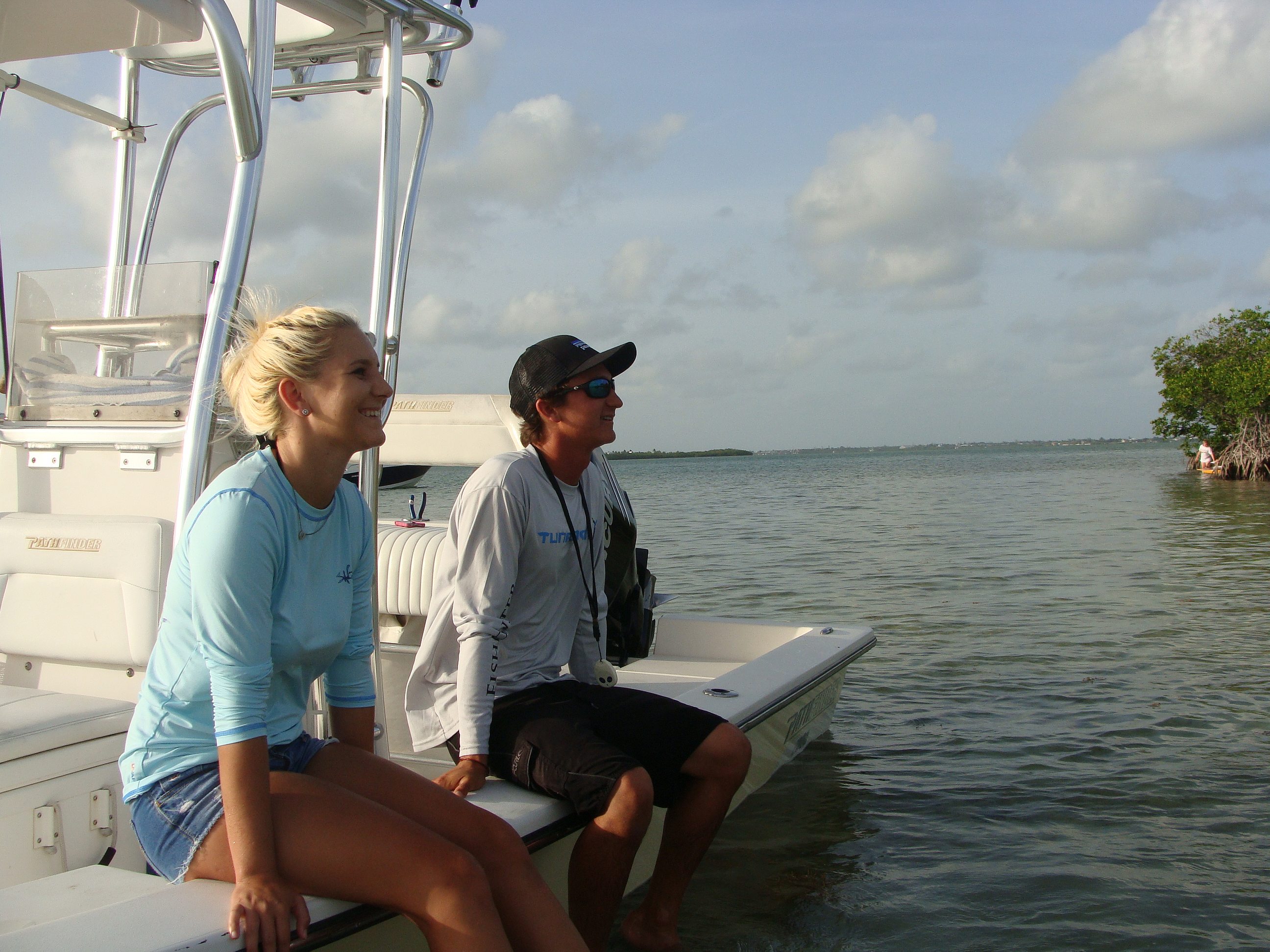
A.J. was born and raised in the Florida Keys after his parents came down here on honeymoon and decided they were never returning to Massachusetts, where they’d met and married. His earliest memories are of the ocean; he started taking small boats out on his own when he was seven. The first time he tried to kiss a girl, he recalls, was at a place locals refer to as “Picnic Island.” The two were sitting on mangrove branches, their feet dangling over the water.
Not only is “Picnic,” which lacks an official name, on our afternoon itinerary, the girl-now-woman, Ashley, is along for the ride. A couple in high school, they eventually broke up but remain friends. A quiet and thoughtful blonde, Ashley provides a calm balance to A.J.’s quaking energy.
But, as A.J. talks, I understand that he’s not overly excitable. It’s something about being above water. “The reason I free dive and the reason I spearfish is because when you go into the water, there’s no sound,” he says. “You hear coral you hear snapping of fish or crabs. Just like other people do yoga or listen to music, we go diving, that’s our little escape.”
Before we board the boat, he shows me the route on Google Earth. We’ll also go to a spot A.J. calls “Rocky Island” after a dog that doesn’t get on well with the other household pets. A.J. takes him there to run.
A.J. adds that “Rocky” is only an island during high tide, when the water severs it from the rest of Big Pine Key.
I suck air through my teeth. “I’m not sure that counts.”
“It’s an island,” he nods. “You’ll see.”
I ask A.J. how he defines one.
“Seclusion. An island is basically separation from other islands.” The mainland isn’t a reference point.
He insists that mangrove islands, even those you can’t set foot on, count. “They do, they do,” he nods. “And most of ‘em have names.”
Ashley points out that she spent her afternoon on one such island, close to the canal that we’re setting out from. “It is walkable,” she insists. “There’s sand in the middle. But you gotta work your way in.”
I’ve been imagining an island as something with a beachy shore and a green interior. From her experience, Ashley understands it to be the opposite: a ring of trees, protecting hidden sands. What looks to me like an impenetrable thicket is, for Ashley and other locals, a curtain of privacy.
When we arrive at “Picnic Island,” I’m surprised to see half a dozen boats idling offshore. After we drop anchor, we wade towards the golden sand before us. Three sides of the island are flanked with mangroves, making the beach seem like a stage.
On it, I find camping chairs carried ashore for the day and rusted barbecues that have taken up permanent residence. A tiny blonde boy, his limbs turned the color of caramel by the southern sun, stands before a cluster of signs. One marks this “Picnic Island.” The rest are arrows giving the distance to destinations like Lafayette and Asheville; a sign tells me that the Carpenter family of Madison, New Jersey (1,409 miles away) visited.
Knowing the distance to other locales means that I can’t forget where I am. For me, that’s half the point of an unnamed island—placelessness, if there’s such a thing.
Nearby, two middle-aged couples sit facing the water, the mangroves their backdrop.
Children make their way through the trees. Rather than using the beach to walk onto the island, they’re climbing their way in.
“This is our childhood right here,” A.J. says, gesturing towards the kids. He describes the moment he tried to kiss Ashley in those very mangroves.
“I probably ran away,” Ashley laughs.
A.J. paces the sand, stopping only to part the mangroves and point out the Atlantic. He calls my attention to a rope hammock, waiting in a shady alcove. It’s a quiet corner of an island that is otherwise buzzing with families.
I notice several chest-high palm trees, ringed with stones. A.J. explains that many locals bring their dogs to Picnic Island. When their pets die, they bury them here or erect memorials on the beach. A laminated piece of paper, anchored by two rocks, serves as a placard at the base of a palmetto. It describes a yellow lab, Jesse, who spent hours “looking for and chasing fish” in the shallow waters surrounding the island. A roughhewn wood headstone marks another burial spot.
Picnic Island has the look I’ve been searching for. But it’s littered with signs and memories. And it’s missing the seclusion that, for A.J., defines an island.
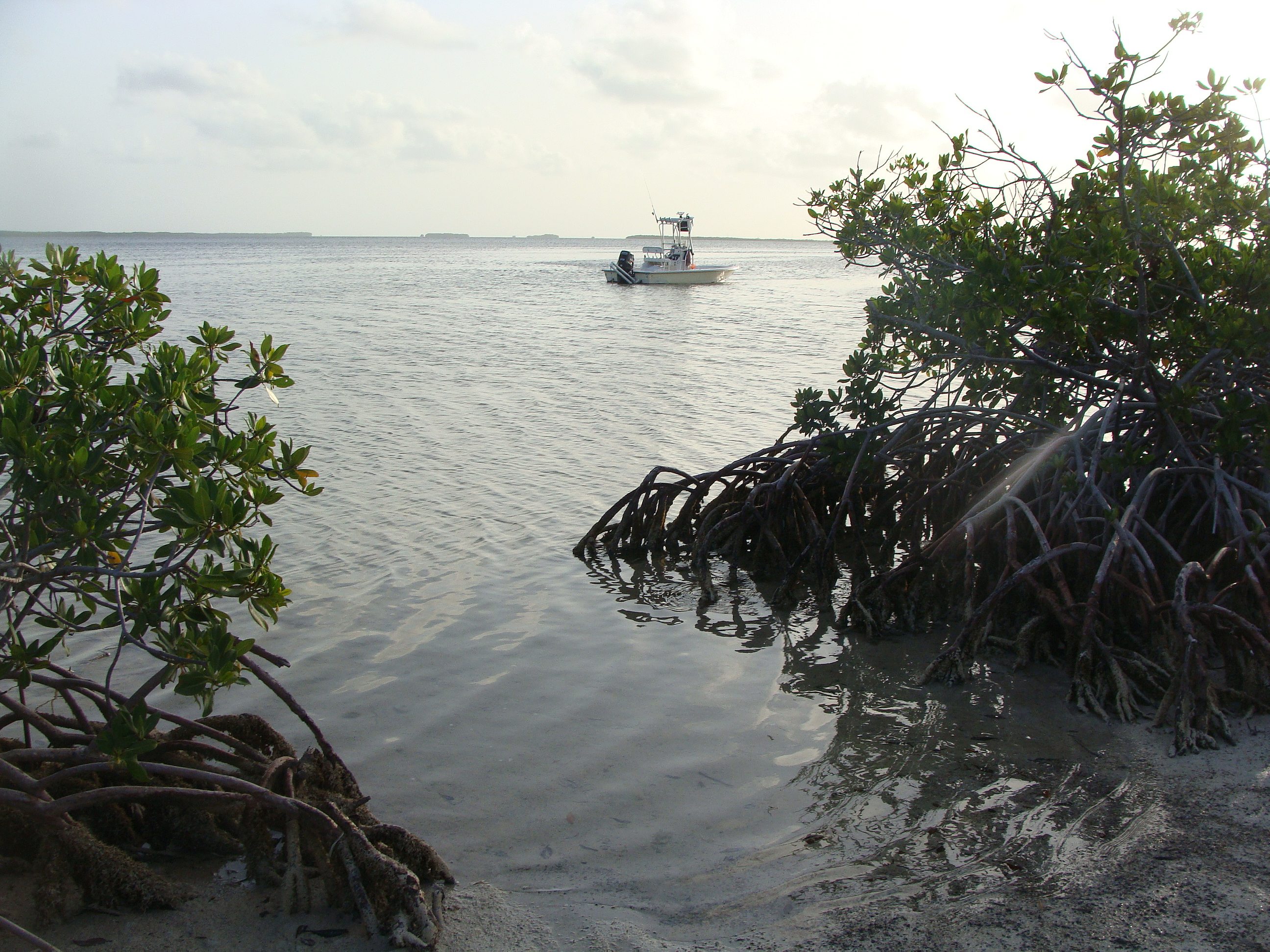
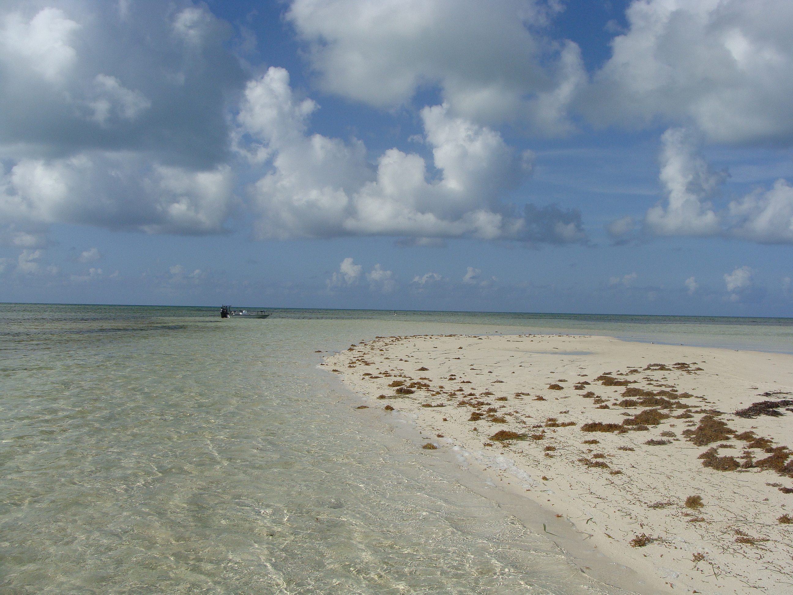
We motor on to “Rocky Island.” As we approach, I see a welcome mat of white sand laid out between the mangroves. There’s not a man or skiff in site.
Keen to reach land, I’m the first off the boat. My foot sinks deep into the muck—so deep that I have a hard time pulling it up. A.J. joins me, offering me his arm to steady myself.
I insist that I can manage on my own. Then I realize that I can’t. Only after I accept his arm do I manage to free my leg. Clouds of sand rise from the bottom and A.J. warns me to “watch out for the jellies,” small jellyfish that we’re stirring up with our steps.
He catches one, cradling it in his palm, “They’re harmless, see?”
“That’s ‘cause you’re holding it upside down,” Ashley says, rolling her eyes.
We reach dry sand without incident. I step onto the land and peek around the mangroves. The beach opens up before me, a soft hill of pure white, like a sugar mound.
A.J. announces, “This is an island.”
He paces the strip of sand, noting a horseshoe crab’s abandoned exoskeleton; a delicate, recently hatched egg; tiny shells that will, eventually, become sand. He picks up what looks like a brown green bean.
“Mangrove seed,” he explains. They float, take root where they can. It’s one way new islands begin to form.
A.J. keeps moving. As I follow, he tells me a local legend about the place. Supposedly, a drug dealer buried his fortune here. A friend “sold him out”—whether to police or rivals is unclear. In either case, the fellow ended up dead and his buddy dug up the money. Hence, the hill of sand.
A.J. shrugs, “I don’t know if it’s true. It’s just a story.”
Seclusion, white sands, a legend—“Rocky Island” feels more like an unnamed island than Picnic Island. But is it an island if it’s attached during low tide? St. Augustine’s “Conch Island”, in North Florida, holds some clues.
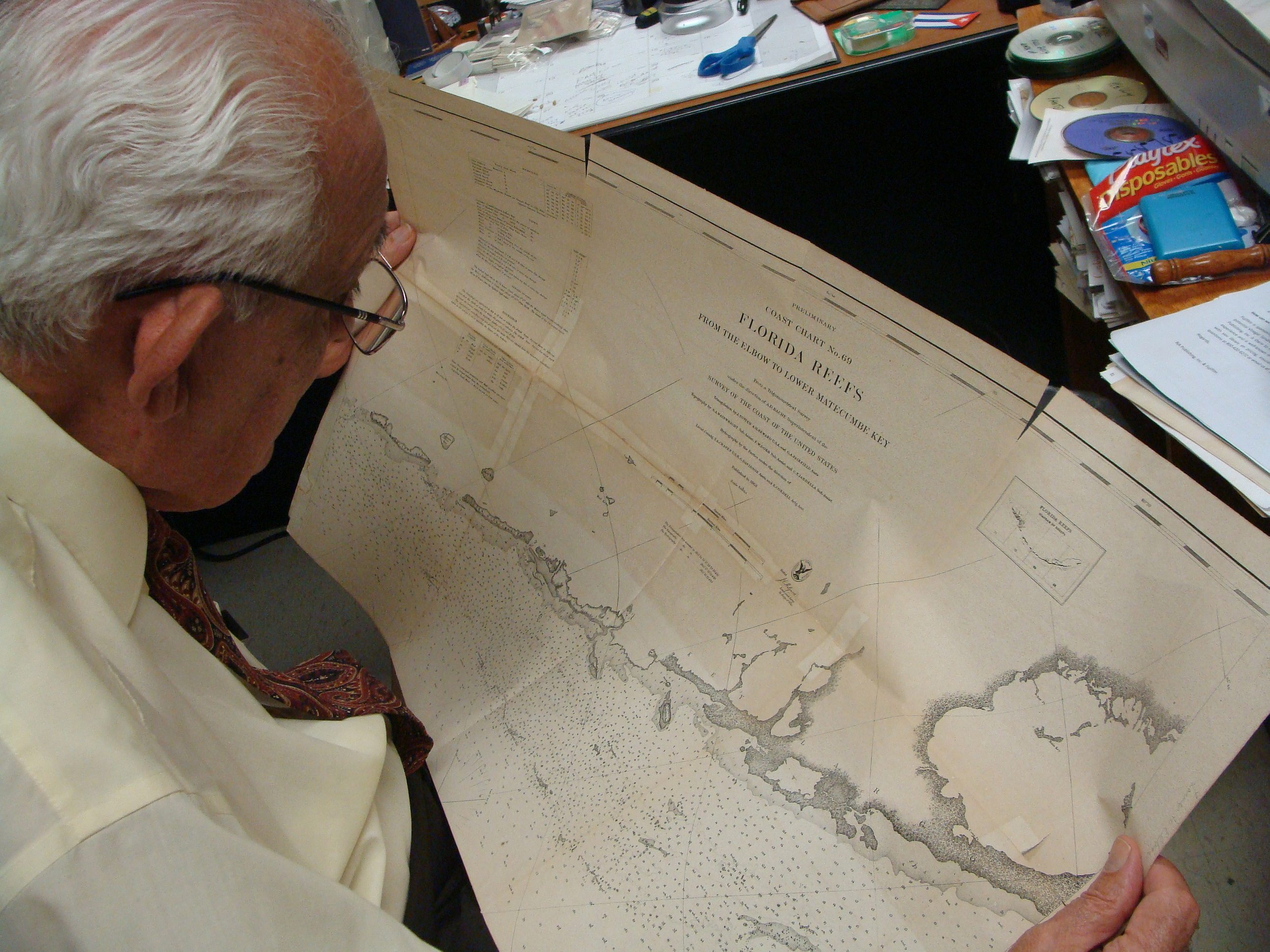
Nearly everyone I speak to in St. Augustine says I need to interview “Brendan at the lighthouse.” From the fellow who sits next to me at a greasy spoon diner to owner of a rare maps shop to the historian, Brendan Burke’s name comes up again and again.
On a rainy afternoon I head over to the lighthouse on St. Augustine’s Anastasia Island. Though I lived just a few blocks away for two years—and grew up a ninety-minute drive from here—I’ve never visited before. I’m surprised to find that the lighthouse isn’t actually on the water. Of course, it was in the past. But both nature and man have had a hand in changing the coastline.
Burke’s office is in a small white building adjacent to the lighthouse. Considering his towering reputation about town, I’m expecting an authoritative look. Maybe he’ll peer over glasses, portly, with a neck wattle. Instead, I find a lean blonde who appears to be in his early to mid-thirties. The pot on his desk—“Lunch,” he explains after I accidentally bump it with my elbow—lends his office a relaxed look.
I tell Burke, a maritime archaeologist, that I’m working on a story about unnamed islands, which means understanding how places get names to begin with. I mention that during my studies of Google Earth and various atlases I’ve noticed irregularities. I’m also wondering about islands that have popped up and disappeared.
Burke listens, his brow furrowed. His speaking, I’ll find, is just as intense—rapid fire, swirling sentences dense with history. But he peppers them with “you know,” a verbal tic that puts me at ease.
“For the past two and a half weeks,” he begins, “we’ve been steaming out in the inlet here and on the electronic chart that we have on the boat, it calls what we call Conch Island—which is to our east right now and which isn’t really an island, it’s part of Anastasia but it’s called Conch Island because, you know, 400 years ago it was dryish at low tide and covered at high tide. So, you know, we call that Conch Island, erroneously now, but on the chart it’s called Cape Francis. I’ve never heard anybody in town ever call it that.”
“How did it get that name then?”
“Someone [in the U.S.] charting office,” he shrugs. “They got it from somewhere. Who knows?”
He adds, “There’s multiple stories, too, as to how this island got its name: Anastasia.”
Burke produces an image of a 1783 map. In Spanish, the island has the lengthy moniker Isla de Santa Anastasia o De Matanzas—St. Anastasia Island or Slaughter Island.
A stark decision: redemption or death.
That morning, at Bouvier’s Maps & Prints, I saw an 1855 map that reads “St. Anastasia Island.” But by 1857 the Saint was gone. A minister from the nearby Episcopalian Church who dropped in to chat with owner John Bouvier mused that, perhaps, a Protestant mapmaker got rid of it.

His explanation was as good as any, seeing how neither Bouvier nor Burke know why St. Anastasia won out over Slaughter, only to morph into Anastasia. A historian I interview can’t explain it, either—in fact, he admits that he didn’t even know that Anastasia Island once had Saint attached to it.
“The mystery persists,” Burke remarks. “Then you get complete conflict like when you see things on charts like ‘No Name Key.’”
He’s referring to an island a short drive from the Barnacle. I spend an afternoon there only to find no beaches, no central gathering place, no stores, no restaurants, only residential areas. But the neighborhood streets are empty, save for parked cars. The locals are shuttered into their homes, every fence studded with “No Trespassing” signs.
Conflicted names and unnamed islands persist off the coast of St. Augustine, as well. Google Earth identifies part of Anastasia as Bird Island; of this, Burke remarks, “I’ve never heard anyone local call it Bird Island. If you’re in town and you say, ‘I’ll meet you at Bird Island,’ you’re gonna go here,” he points at a different locale on the map, which is unnamed, according to Google Earth. “That’s Bird Island.”
Burke’s finger comes to rest on another piece of land, “Kirths’ Island. Never heard of that.” He adds that while this insignificant island has an official name, another island that “is one of our most sacred pieces of earth” remains unnamed: Fort Mose—which appears on Spanish maps as “Puerto Negro” and is sometimes called “The Negro Fort”—once stood on that land.
St. Augustine is America’s oldest continuously occupied settlement
“That’s what protected St. Augustine for so long from the marauding Georgians in the 18th century. That little speck here, Kirths’ Island, who the hell cares? But this one here,” he gestures to the site of Fort Mose, “has huge significance for St. Augustine’s history.”
Growing up in Florida meant class trips to St. Augustine, where we visited a different fort, the Castillo de San Marcos. It was founded by the Spaniards and—according to version of Florida history I learned at school—ensured the survival of St. Augustine, America’s oldest continuously occupied settlement.
But Fort Mose is north of San Marcos and was the first line of defense when the British came from Georgia and attacked Florida.
Africans who’d escaped slavery in the British colonies fled to Florida. In 1738, with the blessing of the Spanish colonel governor, they established Fort Mose. According to the Fort Mose Historical Society’s website, this was the “first free African settlement to legally exist in [what is now] the United States.”
Of course, the Spaniards didn’t give them sanctuary without demanding something in return. The British Georgians had long had their eyes on northeast Florida; for a century, the Spaniards lived under threat. And so Fort Mose became the sentry for the rest of St. Augustine.
When the British finally attempted to invade in 1740, the strategically positioned black fighters hit them hard with muskets. “You gotta start punching early and often,” Burke says. “They sopped up a lot of the [British] energy.”
By the time the marauding British reached the Castillo de San Marcos, they were weak enough that the Spaniards could hold them off.
Naively, I wonder aloud why this isn’t part of the narrative I learned at school.
Burke nods, “There’s the story of not only protecting St. Augustine but that’s being done by people who emancipated themselves from a cruel system and who, at peril of life and limb, took the risk to come down here.”
“It’s a very American story,” I say.
“It is. But it takes place under the Spanish flag and they’re black.”

I head to the unnamed island that’s home to Fort Mose. Or, rather, I head to the site that the settlement used to occupy. Nothing remains of the original wooden structures.
The blink-or-you-miss-it entrance is on a busy stretch of U.S. 1. And I do, in fact, miss it. After a U-turn—and after Waze directs me not to the park entrance but to a dead end street adjacent to the park—I arrive at the place that was so important to St. Augustine’s survival only to find it all but empty.
Inside the small museum, a young, African American family of four mills about, looking at the exhibition. Park Services Specialist Vicki Tiseth is there, too, and when I ask her whether or not the island that was once home to Fort Mose has a name, she confirms that it doesn’t.
It wasn’t always an island, she adds. When the settlement was here, it was all one piece of land. We’re standing on what was once the residential area. The fort itself was on what is, today, an island.
“How can I get there?” I ask.
“During low tide, you can walk.” She explains that I can climb on the boardwalk, which veers left, and take a path that cuts through the marsh towards the sometimes-island. But, when the tide is up, the trail is impassable and the island can’t be reached on foot.
Tiseth welcomes me into the office, where she uses the dry erase board to illustrate. She curves her pen across the board in one smooth stroke, simulating the rising water, severing the path.
“It’s an island,” she concludes.

Burke recommends that I speak about the Keys to Tom Hambright, a historian at the Monroe County Public Library. Burke describes Hambright’s preeminence: “If he doesn’t know about it, it didn’t happen.”
Located in Key West’s historic Old Town, the Monroe County Public Library is nestled between tiny cottages and grand gingerbread houses. A one story, pink building, its paned windows are edged by large white shutters. The entrance is topped by a Southwestern façade and is framed by palm trees. I enter and find Hambright in the archives.
Hambright eases his tall, lanky frame behind his desk. His has long, elegant hands and gestures so much as we talk that I can’t get a clean photo of him. He’s got a heavy Southern accent, not the twang I’m used to from my native North Florida. It’s a refined accent that conjures lazy afternoons on a wraparound porch.
Hambright, I learn, is from North Carolina. While his skin has a distinct olive tone—and I surmise that his white hair was dark when he was young—I wouldn’t guess from his appearance that his maternal grandmother was part Native American.
His heritage, Hambright explains, accounts for his love of history: Both his grandmother and her grandmother were “storytellers who told the tribal history. My grandmother used to tell me stories when I was very little… and before I could even read and write I got interested in history.”
Hambright guesses that she was Cherokee but isn’t sure. His grandmother wasn’t open about her Native American roots, he says with a wry smile, “Because this was in the 1950s and mixed race people didn’t go well in the South.”
Just as his grandmother regaled him with their ancestors’ tales, Hambright shares with me the story of the Keys’ names.
First, we need to bear in mind that Florida changed hands numerous times. Initially settled by Native Americans, it was first colonized by the Spanish. The Spaniards ceded control to the English, in exchange for Cuba, only to regain the territory briefly before Florida joined the United States of America in 1845.
According to Hambright, the English changed all the names. When the Americans came along, they changed them again or “corrupted the names.” But, he adds, the mangling likely began with the Spanish, who “probably” based names on “what they thought they heard the Indians call” places. The Spanish were not always accurate interpreters. But they were the first to put things in writing.
Both names and history were lost amid all the shuffling. And, as is the case in North Florida, mysteries persist.
“Indian Key?” Hambright muses. “Why did [the Spaniards] call it Indian key? And why in 1840 did the Indians raid the [American] settlement [there]?
“We don’t know,” he says. “Maybe it was just part of the war.”
Or maybe not. “Supposedly the island meant something to [the Indians],” he explains. “But we have no written record.”
To that end, “we have Stock Island but there’s no record of any stock ever being kept [there]. Possibly a man named Stock owned it… We know that in the early days, you couldn’t have livestock in the Keys because the mosquitoes would kill them. The mosquitoes were so thick that the animals would breathe them in and actually drown.”
Florida’s early coastal settlers had a very different relationship with the mainland, the islands, and the water than we do today. Just as A.J. said that “an island is basically separation from other islands”—reminding that his reference point is the ocean and not the mainland—we need to flip our point of view if we’re to understand many of the Keys’ names.
We need to center ourselves on the water and understand land through a navigational lens.
“Water was the avenue, land was the reference point,” I say to Hambright.
He nods, “Which you wanted to stay away from because you didn’t want to run aground.”
So some names are based on what the islands looked like from the ocean. “You have the Pine keys,” Hambright says, because the tall, thin trees were visible from the water. “And Sugarloaf. There’s always a sugarloaf when there’s sailors involved… They’re hungry, they’ve been eating sea rations. They would look ashore and say ‘ahhhhh,’ sugarloaf.”
Both the locals and the U.S. government played a role in solidifying the Keys’ names. In the 1930s, the National Oceanic and Atmospheric Administration’s predecessor came down to Florida to update the nautical charts. According to Hambright, they conducted a survey around the Seven Mile Bridge, “asking some of the prominent locals [and] nautical people… ‘What do you call this island, what do you call that island?’ If three said it was Thompson
Island and one said it was Smith Island then it [became] Thompson.”
That they concentrated their efforts in the Middle Keys could explain why some islands in the southern stretch remain unnamed.
But, ultimately, “it was up to the chart maker,” Hambright says. And, as Google Maps reminds, even chart makers get things wrong. Such is the case with Man and Woman Key, both of which are southwest of Key West (meaning that the latter is neither the “Southernmost Point” in the continental U.S., nor is it the westernmost key) and which are adjacent to one another.
“Before World War I,” Hambright explains, “The western [island] was Man Key and the eastern was Woman Key. And some time in there when they did a new chart, they got reversed—Man Key became Woman Key and Woman Key became Man Key.” He guesses it was probably a mistake.
Name changes continue today, mostly for commercial reasons. What was long known as Tank Island, for example, has been rechristened as the more marketable Sunset Key.
It’s not just names that are in flux. The land itself is, as well. “Some of those keys come and go,” Hambright says. “In the [Dry] Tortugas, during the Civil War, there was an island that had the hospital and the cemetery on it and it disappeared. Gone.”
He adds, “Every once in a while some of them come back… You never know because there are sand islands. Sand Key which is close to here, where the lighthouse is, comes and goes.”
One such spot popped up in the wake of 2005’s Hurricane Wilma. Though it remains unnamed on maps, locals have dubbed it (wait for it): “Wilma Island.”
For an island to be an island, it must contribute to the ecosystem
No matter what other Key Westers call the place, fourth generation native Brandon Cyr doesn’t consider “Wilma” an island.
Cyr wears the same I-live-on-the-water-uniform as A.J.: long sleeves, shorts, baseball cap, sunglasses. A tall man with broad shoulders—during the course of our conversation, I gather that Cyr hits the gym—the delicate features of his face don’t seem to match his body. His blue eyes, ruddy cheeks, and small nose lend him a boyish look.
As we seat ourselves on a bench at the Key West Marina, Cyr explains that an island is “Something that is above water long enough that it can sustain life… it doesn’t have to grow vegetation but, you know, maybe turtles can nest on it. Once that [land] goes underwater, any turtles that are under [the sand] would suffocate. So it has to have air.”
The key: For an island to be an island, it must contribute to the ecosystem. And Wilma?
“It’s a little sandbar,” Cyr says.
He would know—he sees it almost every day. Like his father, Cyr makes his living in these waters working as a fishing guide. His earliest memories are of boats; he started steering when he was four or five, “my father would tell me what degrees to follow and I’d just do that.” He got his first boat when he was seven. That’s how he learned the backwaters surrounding Key West.
“The first boat had a little one horsepower tiller, I couldn’t go more than three miles an hour,” he recalls. “Every thirty minutes you had to use the VHF radio to tell your parents where you’re at. There would be a basin and they would say, ‘Go out there and stay there.’
But, being kids, we would venture out. That’s how I found a lot of these back ways, the side channels.”
Today, he navigates without a nautical chart or GPS, using memory and sight. Water color speaks depth. “There’s a rhyme,” he says. “Brown, brown, run aground.”
It could happen to an inexperienced boater out here. In part because the coastline isn’t static.
“Like Wilma [sandbar],” Cyr says. “All it takes is one hurricane to wipe it in, wipe it out… You can go to the exact same spot the same time of day but you’re going to see something different. It’s always changing.”
Early the following morning we meet at a Key West marina with a menacing name—Hurricane Hole. Cyr’s boat is long and flat, built for shallow water and designed to absorb the shock of riding over waves. He helps me on and frets about my condition, insisting I sit in the back where it’ll be less bumpy and I’ll be less likely to vomit. I scoff. I’ve never gotten seasick and I’ll be damned if I do today, pregnant or not. As always, I sit in the front where the view is best.
As we slice through a channel that connects the Gulf of Mexico with the Atlantic Ocean, I see a houseboat that’s more house than boat. Is that an island? I think. Though it’s floating, it’s a permanent fixture on this stretch of water and it’s adorned with an American flag. If a Cuban refugee reached the houseboat’s porch, would the Coast Guard turn them around? I wonder.
We stop at a spot of sand in the middle of nowhere. Cyr explains that it’s actually part of a reef, and it sticks out of the water “permanently.” It’s littered with dark brown rocks and mustard-colored seaweed. Cyr doesn’t consider it an island. Yet. If mangrove seeds find their way here, the place could grow and become more hospitable to life.

Surrounded by crystalline water, I get out of the boat and immerse myself. On the horizon, blue skies palm the open sea—two hands meeting in prayer. Here, it’s easy to understand why humans once thought the world flat. I feel like this might be the last bit of land until the end of earth.
We cruise to another sandbar, a crescent of pure white set in emerald shallows. Black Cormorant birds stand in a neat line, facing the rising sun. They open their wings to dry them; it looks like they’re greeting the new day. I ease towards them, not wanting to disturb the ritual. When I’m too close, they lift themselves into the sky at once, an inky line.
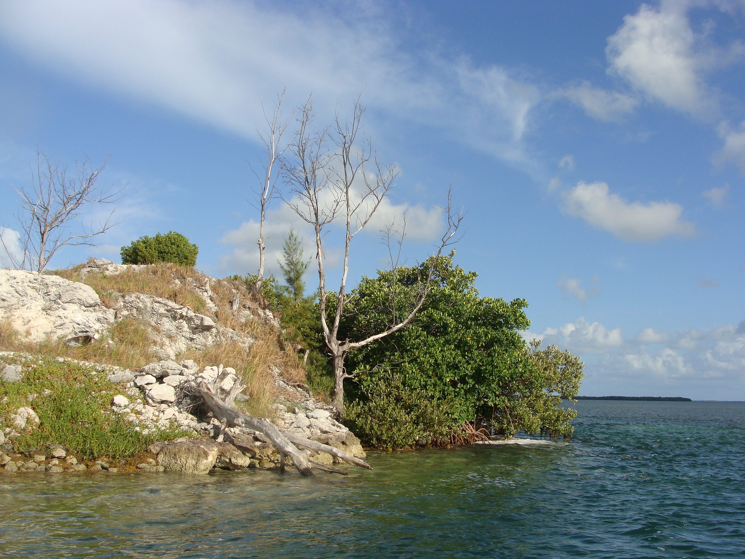
After we pass the transgendered Man and Woman Keys and Boca Grande, Cyr steers the boat towards a large unnamed island. It reminds of a chunk of malachite that’s been plunked down in the sea and, when we arrive, we find the exterior as green and impassable as the stone.
We circle, looking for a way in. The mangroves bend, doing their best to keep us out. The trees are taller, their roots longer and thicker than I’ve seen elsewhere. Here, sunlight can’t penetrate the water, which looks like primordial goo.
Cyr pulls into a canopy and kills the engine. Birds fill the branches above us; their calls collide in the air. I realize that this island doesn’t just look different. “This place sounds different,” I say—it’s denser with birds than any other island I’ve visited. Cyr agrees, describing the scene as “prehistoric.”
Though we don’t manage to find an entry point, something about the place fills me with the feeling I’ve been searching for. Here, it feels like man—and all the complications that come with being human—doesn’t exist.
We forge on to two unnamed islands near Kingfish Shoals. Locals call the pair “Destroyer Key.” According to Cyr, legend has it that a U.S. navy destroyer lost its radar and ran aground here in the 1960s. The navy had to come and dig the ship out; the rock that they excavated from under and around the boat became the foundation of the two islands.
The result is fraternal twins: one is flat and dense with mangroves. The other is a wild outcropping of stone studded with sea grass, pine trees, and dead, grey branches.
This is the unnamed island I’ve been searching for. As I scramble ashore and follow a trail up the hill, Cyr stays with the boat and admires the animals in and above the water. “It’s wild to think that all this life came from a mistake—from someone running aground in the 60s,” he muses.
I hike barefoot up the rocks, stopping to pick sandspurs out of my toes and heels, the chalky sand turning the soles of my feet white. When I reach the top and look out over the water, I realize that I never wanted sand. I wanted solitude.
Time passes in silence, save for the cooing of two doves. I watch the sun dance on the ocean. I notice a few small mangroves, their leaves tinged yellow. Aqua waters below are turquoise further out then navy on the horizon, where another island awaits.
“A lizard!” Cyr calls from below. As much as I want to be alone, I’m relieved to hear a voice—I remember that like coastlines people are fickle things.
I follow the trail back down the short hill to have a look.
“How does a lizard get out here?” Cyr wonders aloud.
I imagine it hitching a ride on a boat, either companion or stowaway. Or, maybe, it climbed out of the sea like our first ancestors, at once in search of and hoping to escape those like himself.