In an Ecuadorian city in the shadow of one of the world’s most dangerous volcanoes, residents steel themselves for the Big One.
This neighborhood, Campo Verde, or Green Country, was abruptly abandoned in August 2015 when Cotopaxi erupted for the first time in 70 years, causing residents in the region to panic and flee to safer ground, some never to return. Only a few miles from the volcano’s summit, Campo Verde will be the first Latacunga neighborhood destroyed during a major eruption. This event was unexpected, but relatively minor—a few small eruptions of steam and ash, rather than the far more dangerous lava eruption people feared. But it signaled that Cotopaxi—meaning “throat of fire” in the indigenous Quechua language—is likely to be gearing up for a more serious event, the kind that could destroy Latacunga, which has a population of 98,000. The biggest threat to the city from a volcanic eruption is from lahars—powerful, cement-like flows of water, mud, and other debris that rush down the volcano’s flank when lava melts the summit glacier. Three times in recorded history—in 1744, 1768, and 1877—major lava eruptions destroyed the volcano’s glacial ice cap, and the resulting wave of wet cement leveled everything in its path, including most of Latacunga, just 15 miles away. Each time, the city was rebuilt. Although the 2015 eruption was modest, Cotopaxi’s unexpected awakening—nearly 150 years after it last destroyed the city, and almost a lifetime since its last small eruption in the early 1940s—had a profound effect on life in Latacunga. Above all, it forced its residents to adjust to the suddenly more likely prospect of disaster, steeling themselves for an eruption scientists believe is a matter of when, not if.
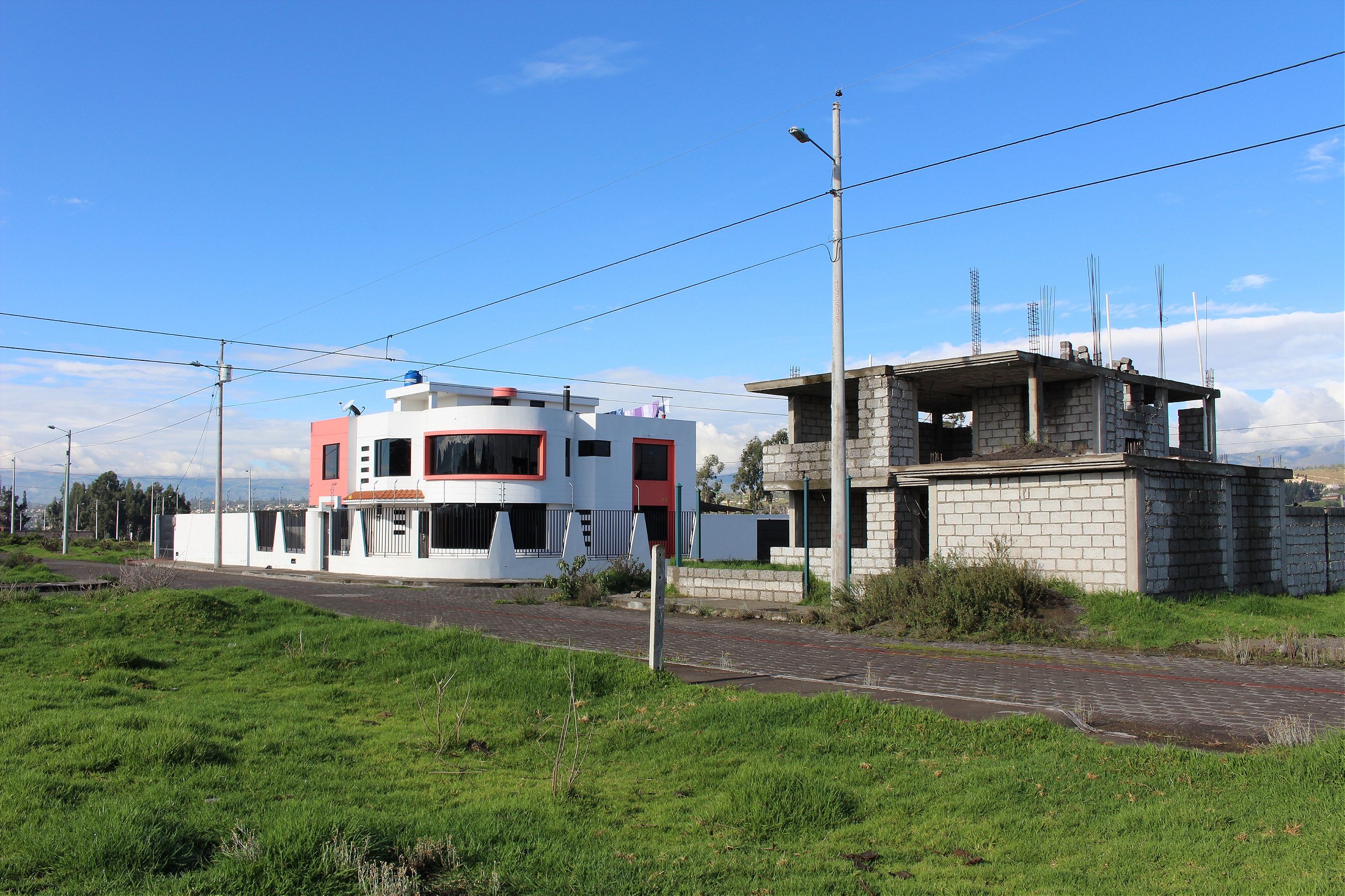
I saw Cotopaxi for the first time more than a decade ago while traveling through Ecuador. I had stopped in Latacunga to rest after a long bus ride, and spotted it from the roof of my hotel the next morning. Later, I would learn that clouds almost always obscured the summit, but that morning the snow-capped peak stood in sharp contrast against the blue sky. The earth seemed to bend to Cotopaxi’s will, rising gently for miles in each direction before tapering steadily upwards to form its dramatic silhouette. I was drawn to this striking view, and decided to stay in town a little longer. For the next three years, I worked in Latacunga as an English teacher. I’ve been coming back ever since—this time, to finish writing a book about my experiences in Ecuador during the 2005 popular revolt and the ouster of President Lucio Gutierrez. When I heard about Campo Verde, I jumped at the chance to live in the shadow of Cotopaxi. Every morning before I start writing, I walk out onto the deserted streets and look north, hoping to catch a glimpse of the ice-capped summit. Campo Verde was supposed to be Latacunga’s next great neighborhood when roads, water pipes, and electricity were laid out in 2013. Few people in Latacunga were alive the last time there was any significant volcanic activity, and the spectacular view of the volcano was regarded as a draw rather than a hazard. Houses started going up in 2015. Then it all stopped. After the eruption, the city put a freeze on all new construction permits. Most of the lots had yet to break ground. Luis Gabriel, 40, works on the military base in Latacunga. He lives with his wife and two children in a gated, two-story, lime-green house in Campo Verde. The house is something of an island; the lot in front is full of weeds, the one behind is growing corn. The house was under construction when Cotopaxi erupted. “I wasn’t sure if we should just abandon the project,” he tells me. “So I did some research. And I visited Cotopaxi and followed along where they say the [mud]flow will go.” Gabriel thinks the next eruption won’t be as devastating as previous ones. “There are a lot of [open pit] mines now, and they will absorb some of the flow,” he says, referring to the mining excavations on the flank of the volcano. The technology is better now too, he adds. The world has changed a lot since 1877. The holes created by the mining industry are new. They might take the edge off the lahars, but it’s impossible to know for sure. Technology for monitoring seismic activity has also improved, but predicting eruptions is still a matter of probability, not precision. A volcanologist can determine that an eruption is likely soon, but not the exact timing or severity.
Diego Travez, 32, works in the mining industry that has sprung up around Cotopaxi. Past eruptions have left rich mineral deposits at the volcano’s base, and now volcanic dust and rock is mined, mixed with water to make a type of cement, and molded into blocks or other construction material. “Cotopaxi gives life to this whole region. This city lives off the volcano,” he says, sitting at the picnic table outside my house. Cotopaxi is fleetingly visible through the clouds behind him. Travez is the third generation in his family to work in the industry. He drives a large dump truck, picking up material around the volcano’s base and delivering it to Latacunga. The blocks made from Cotopaxi’s bounty are used in buildings throughout Ecuador. Travez lives with his wife and two children in what is considered a ‘Risk Zone.’ But, volcano or not, this is home. “I was born here,” Travez explains, “raised here. My family is here. To go anywhere else I would have nothing; would have to start from zero.”

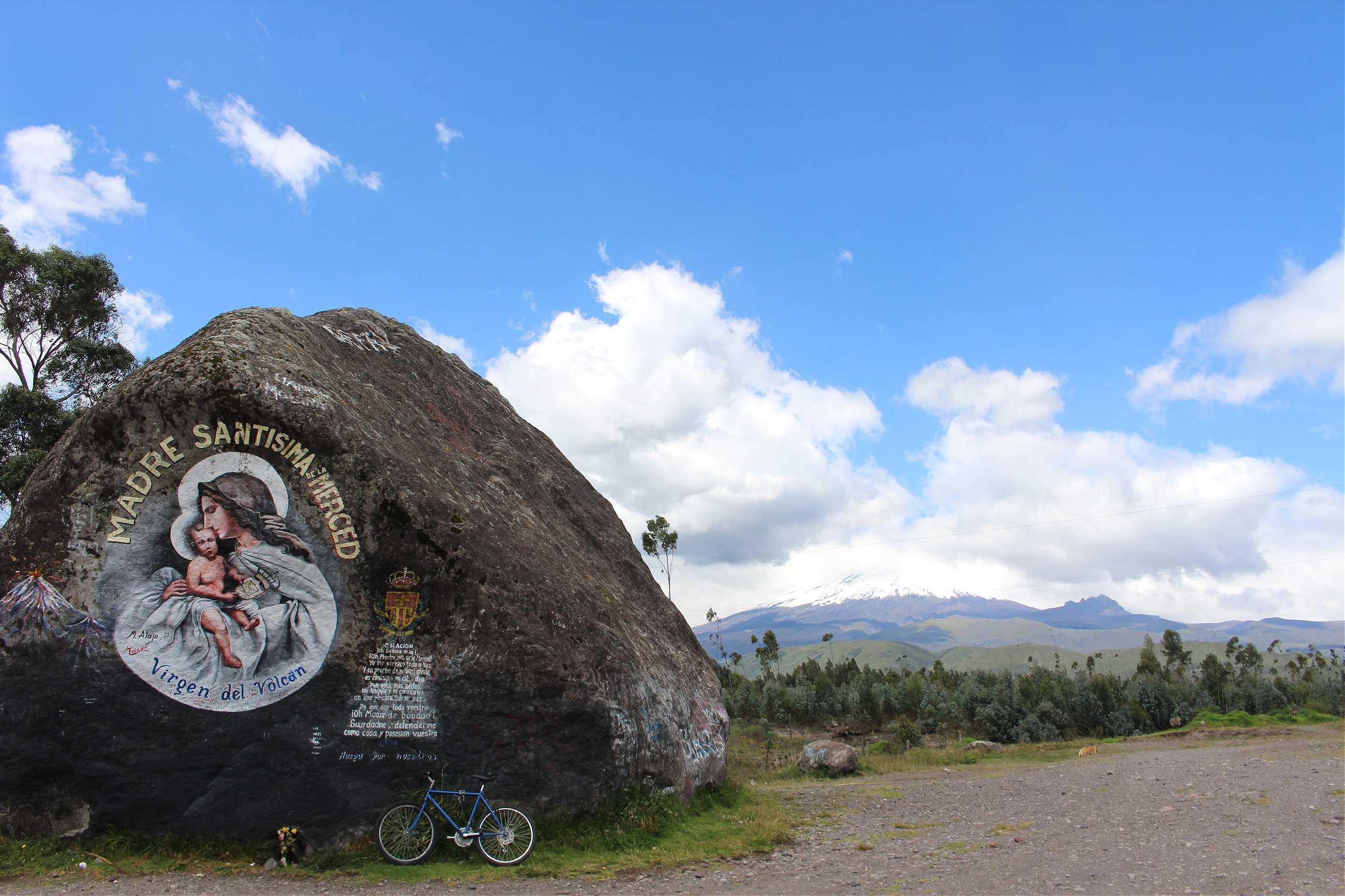
Cotopaxi’s summit sits three times higher than the elevation of Denver at 19,347 feet, but it isn’t just tall: it’s massive. The summit is covered in over 1,000 feet of glacial ice that has built up since the last big eruption. The glacier’s ice-melt trickles down the mountain to form the Río Cutuchi, a river that bisects Latacunga and provides a constant supply of fresh water. Previous eruptions have also filled the area’s soil with nutrients, and the volcano traps clouds in its orbit, creating a moisture-rich microclimate that makes the region ideal for various types of agriculture, from roses to potatoes to a special kind of tomato that grows on a tree. Latacunga is in the center of it all, functioning as a regional trading hub. But the river that sustains the city could also be its undoing. If a lava eruption melts the volcano’s ice caps, the mudflows will follow the small valley that Río Cutuchi carves on its route down the mountain. According to Ecuador’s Secretariat of Risk Management, it would take only about thirty minutes after the ice melts for lahars to destroy most of the city.

Roses are big business in Ecuador. Planeloads of roses, destined for Los Angeles and London and everywhere in between, leave several times a day. Latacunga is full of roses, too. Clusters of flower shops near the cemetery sell them for ten cents each. Ana Panchi, 39, has sold flowers her whole life. She worked in her mother’s shop as a child and grew up to have one of her own on the same block, with small floral arrangements in clay pots crowding the shelves on each side of the shop. She was in her home when she heard that Cotopaxi was erupting. “All that week, it was sunny and everyone could see the steam rising from Cotopaxi, everyone was talking about it.” It was just after sunrise on a Saturday morning when the government declared an emergency and ordered an immediate evacuation. A tendril of steam had been rising from Cotopaxi since mid-April, when magma shifting deep within the volcano had triggered a series of earthquakes. Seismic activity increased over the following months, culminating in a series of explosions inside the volcano early in the morning of August 14, causing at least three eruptions of ash and steam. The ash fall reached as far as Quito. “I was making breakfast when I heard the alarm coming from the military base, so I looked out the window, there.” Ana points beyond the couch in her living room to the Air Force base across the street. Beyond the base is Cotopaxi, although today it’s covered in clouds. “And all these big strong men were running around like little girls. One of them drove out into the street and crashed his car into traffic.” Ana’s daughter, Karmina, 21, also sells flowers. She is finishing her lunch at the kitchen table with her three-year-old daughter as Ana and I talk. She turns toward us and interrupts her mother. “And you started banging on my door then, I remember. You said the volcano was erupting and we had to leave.”
Some people just came back to get more things to carry out
“Yeah, I knew it was Cotopaxi right away,” Ana says. “I could hear the alarms coming from all over the city and I could see people running down the street, a lot of them were carrying dogs. I even saw some running with televisions.” Karmina laughs. “All we took were diapers.” A few hours after Ana and Karmina fled Latacunga for higher ground, the evacuation order was rescinded. “Some people just came back to get more things to carry out. They didn’t want to live in Latacunga anymore,” Ana explains. “A lot of people told me to leave, but Latacunga is my home.” Cotopaxi continued to sputter out steam-and-ash plumes for several months after the eruption before settling down again—an episode that marked the end of an unusually long period of calm for the volcano. Experts say the 2015 event was the start of a new phase of volcanic activity, and that a major eruption is coming. The Geophysical Institute at the National Polytechnic School in Quito reported that the explosions that provoked the eruption were caused by molten rock meeting water deep inside the volcano, resulting in a violent release of steam. The report also noted that “such explosions are common in the stages of reactivation of volcanoes” and can lead to magmatic eruptions—lava eruptions—in the future. Patricia Mothes, a volcanologist at the Geophysical Institute, told The Atlantic in March 2017 that “of the five eruptive periods from 1532 to now—and this is number six—it always ends (or at least has) in a major eruption.”
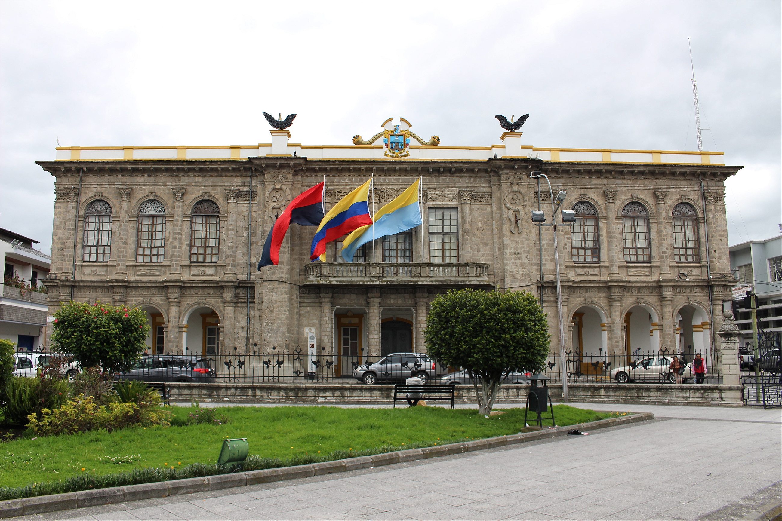
Latacunga’s City Hall, in the heart of downtown, was quite literally built from the rubble of the city’s past destruction: it’s the only seat of government in the world constructed out of pumice—a rock formed by cooling lava. Behind the pumice columns that hold up City Hall, which is now over 100 years old, sits the Department of Planning, where Patricio DeWitt, the city’s current Chief of Planning and Regulation, has been working on volcano-proofing the city. “We are going to grow the city west, away from Río Cutuchi,” he tells me, as we sit in his office. Dewitt explains that the city is going to invest in services such as water and electricity and build new schools in that area. “The people will move to where the services are.” He shows me a map with a big black line outlined around the city, with a bulge toward the west. For the next four years, no new construction permits will be issued outside of that line, he says. The city’s economy contracted in the months following the 2015 eruption. Some people never returned after the evacuation, and some businesses closed down. In the meantime, the town has mostly recovered, and even adapted. “We have always lived next to a volcano,” says Ramiro Viteri, who owns a local tour company. Before the 2015 eruption, Cotopaxi drew climbers from around the world, and Latacunga was home to nine tour companies. But after the incident, the government banned people from climbing to the volcano’s summit, citing the danger of an imminent eruption—a blow to the companies that depended on mountaineering tourism.

“Ninety percent of our business is Cotopaxi,” Viteri tells me in his shop. “People don’t climb an active volcano without knowing there is some risk, but everything in life has risk.” All but three of the tour companies have closed, and the surviving ones have had to make big adjustments. “We used to sell ten tours a day. Now, I’m lucky to have two or three a month,” he says. Before the eruption, he had 24 guides on call; now he is the only one left. A few months ago, he converted a large section of the travel office into a café, where he sells ice cream and crepes. On the wall, ice picks and other climbing equipment hang next to photos from the summit of Cotopaxi, but the photos aren’t recent. “Ninety-nine percent of the business is now the café,” explains Viteri as he serves a crepe to a customer. “I would never leave Latacunga,” Viteri says. “I was born here, and I’ll die here.”