In India, rising sea levels and erosion swallow an island.
The shores of Ghoramara are dotted with dead trees. They tell the story of an unfolding calamity. Islanders call it ‘the slipdown,’ the land breaking off in chunks and falling into the sea. Mud flats deposited by the tides are dotted with old houses and broken mud walls flooded by the encroaching waters. The trees die in the saltwater.
For more than a decade, Ghoramara, located on the Muriganga River 150 km south of Kolkata, India, has been sinking beneath the fast-rising Bay of Bengal. This is a result of a combination of climate change and skewed development policies. Ghoramara is among the 54 islands of the Sundarbans—a vast mangrove delta shared by India and Bangladesh—where massive coastal destruction has left thousands homeless. Ghoramara alone has lost more than 50 percent of its land mass to the sea in the past decade.
In a study published in 2014, the School of Oceanographic Studies at Jadavpur University, Kolkata, found that in 1975 the total area of Ghoramara was 8.51 square kilometers. By 2012, it had shrunk to just 4.43 sq km. Over the years, homes have been swept away, families broken apart, fields have been made barren by the saltwater and livelihoods have been destroyed. Organisations like the Inter-governmental Panel on Climate Change have warned that areas like the Sundarbans will bear the brunt of climate change due to rising sea levels.
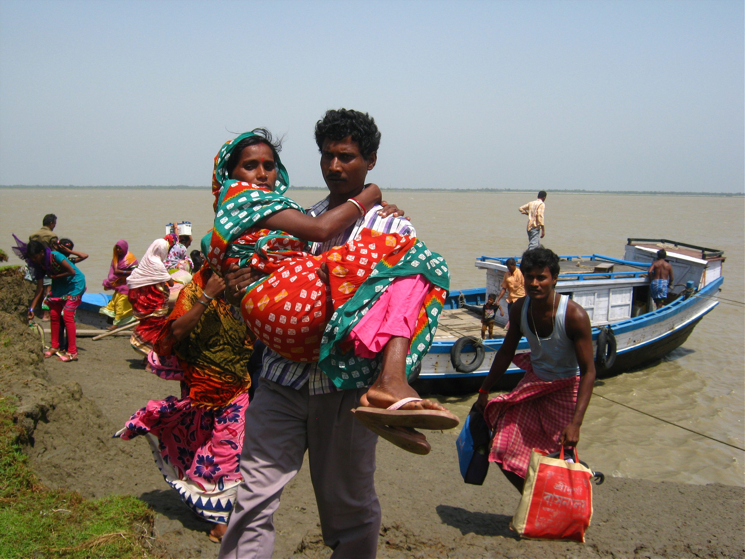
The 5,000-odd islanders have to get to the mainland to see doctors, get to hospitals, banks, and even to buy groceries. The boat makes four trips a day, if the weather permits. The boat to Ghoramara docks at a jetty near Kakdwip, the closest mainland town. People clamber out, struggling against the strong wind churning the waters of the river. It’s 9 a.m. and already the day is unbearably hot and humid. Everything looks bleached white under the merciless sun.
Snigdha Shashmal, wearing a mustard-hued saree, stares across the waters. She is a government health worker, waiting for a boy from the island. His leg has swollen after a routine vaccination and she has to get him to a hospital. “God, those guys in Ghoramara can’t even get an injection right.” There’s just one small clinic on the island, and it closes at noon, Shashmal says.
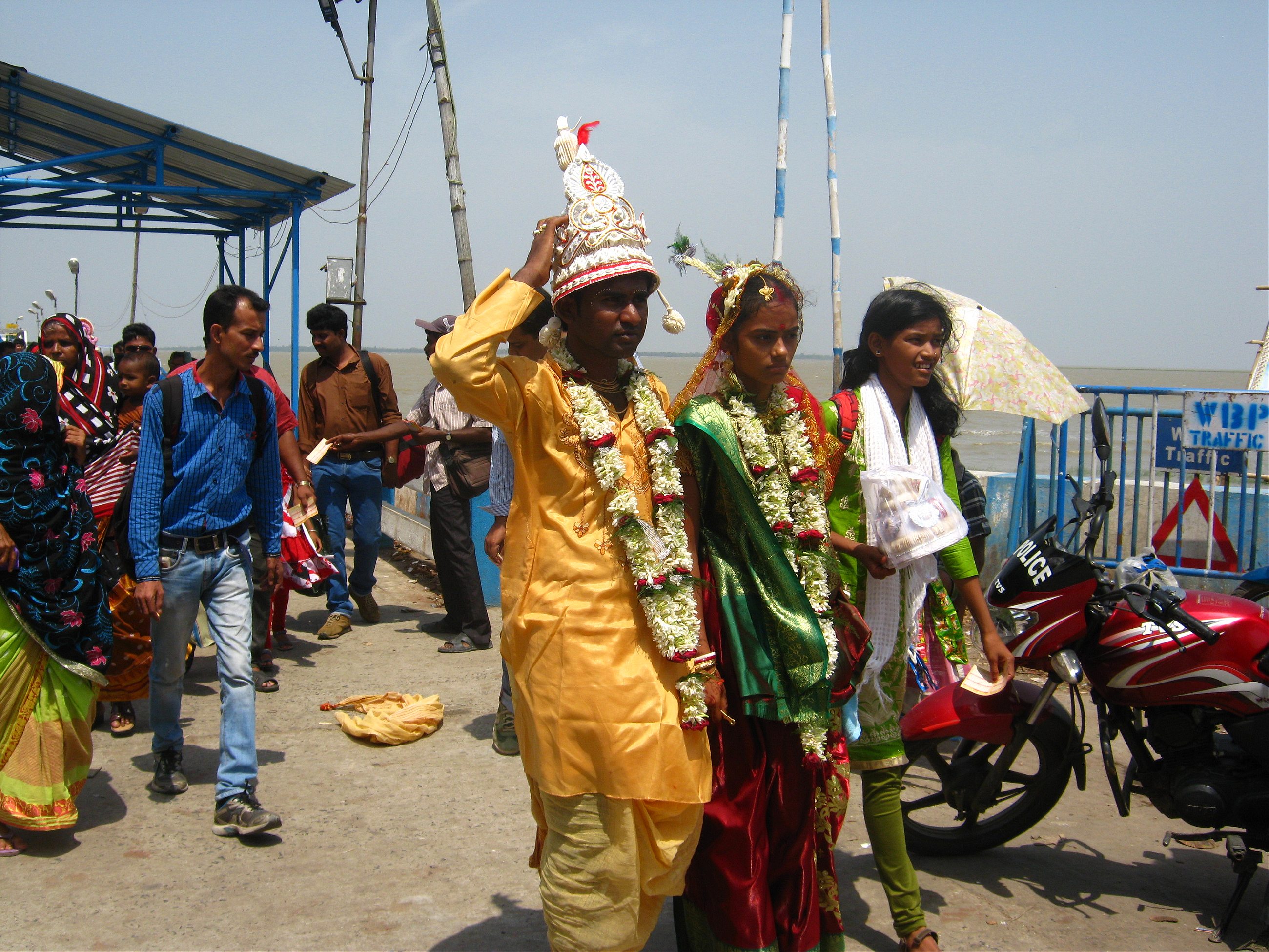
A newly-wed couple gets off the boat decked in wedding finery, faces glistening under the sun. Shashmal knows the girl—she is from Ghoramara too. “She’s managed to get married to a mainland fellow,” she laughs: the girl was lucky to get off of the island.
I’m waiting for the ferry. The queue is quite long and we inch forward slowly. After a hurried debate, the four women in front of me decide not to get on the boat. They are teachers at the government-run school on the island. They make their way back to the shore to call the island to let them know that the teachers won’t be coming to school today.
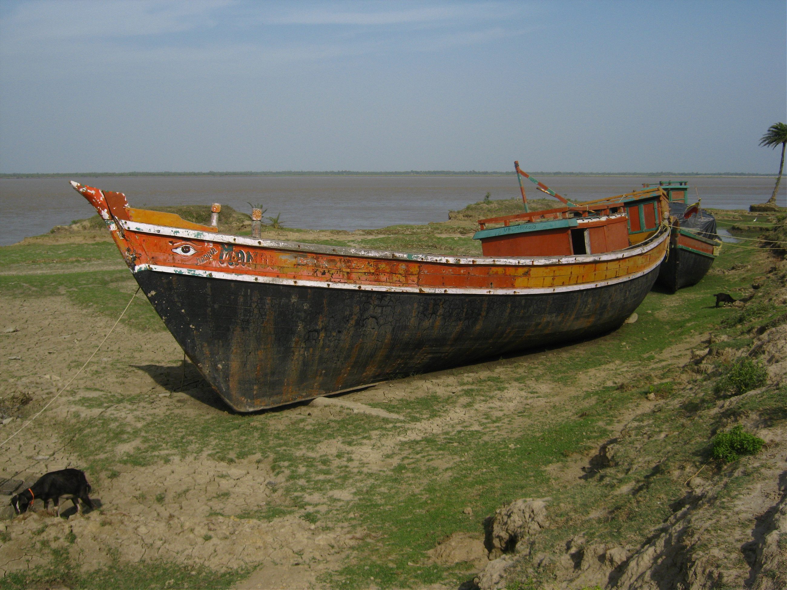
Instead of making a straight line for the island, the boat takes a circuitous route to avoid man-made silt. The government has built barrages and dams. The problem started in the early 1980s when the Kolkata Port Trust started building several underwater walls to divert the river and widen the Kolkata-bound shipping route. The project was abandoned halfway. These underwater walls have led to higher tides and stronger currents. After almost an hour, we reach Ghoramara.
The receding land area has forced villagers to rebuild homes further and further inland as they repeatedly run from invading waters. The islanders’ only defense is a fragile three-foot-high wall made up of the clay-like soil of the island and held up with bamboo sticks.

At any time this island, our world, will sink
Just a few meters from the riverbank, Sheikh Khadim and his wife Arzan Bibi sit outside their small mud house. All that stands between Khadim’s home and the water is the embankment. “At any time this island, our world, will sink,” says Khadim. He has no choice but to live here, perilously close to the embankment, as most of the land he once owned is now underwater.
There is no land left for the family to flee to. This is the third house he has built in the last decade. He fears that the river may swallow his new house too. “We have shifted thrice. I am tired of running from the river.” Three boys in their teens cluster around. “My grandsons,” says his wife Arzan Bibi proudly. “This one wants to learn to repair cars,” she smiles, pointing to the eldest. “But I tell him not to dream too much. God knows what our future has in store.”
Humans arrived here long after nature created a fragile ecosystem built around the presence of saline water. High salinity conditions means non-porous soil and lack of oxygen in the forest area, so the trees have adapted roots that grow up through the mud, creating a carpet of sharp spikes which absorb oxygen. Native wildlife adapts to the conditions—like the famous Royal Bengal tigers, who are agile swimmers and drink saline water. The predominant goddess here is Bonbibi (mother of the forests), someone who can subdue the tiger.

The primary livelihood of the islanders is rice and betel leaf cultivation, and fishing, but when the floods come, the saline water makes the land barren. Most men leave, working as daily wage laborers at construction sites in West Bengal and other states. Some find work on the island under a government act which guarantees livelihoods in rural areas. They build roads and embankments, dig ponds, and plant trees.
Satyajit Metey is in his twenties and works with the gram panchayat (local governance body) here. As we walk around, Metey rattles off the history of the island, interspersed with stories about his family, one of the oldest in Ghoramara. “My grandfather was the first person from this region to pass matriculation [high school] in 1914.”
Metey says the East India Company gave people land in the Sundarbans delta to cultivate crops that would fill the coffers of the Company, and also so the new population would act as watchmen, spotting trading ships from rival nations like Portugal.
“It is said that an Englishman’s horse was killed by a tiger,” so the island was named Ghoramara, which translates as ‘killing a horse.’ The island had another name—Mud Point—given by an Englishman who thought the place looked like a mud dot on the ocean. The debate about which name would suit the island more was solved by Metey’s grandfather, the head clerk at the time.
“He named the island ‘Ghoramara,’ and its post office ‘Mud Point.’ The post office was grand, like a royal palace. It is now under water. The British built it, to send telegram warnings to the mainland of any approaching rival ships or pirates.”
Ajay Patra sits in a beautiful mud house, on a bed with a green mosquito net hanging above. “The islanders share a profound love for their home and don’t want to leave their little rock,” says Patra, whose grandfather was born on the island. Patra used to be the local panchayat head. He points to the trophies on the table which he won playing sports. He remembers his childhood days when the sea was not a menacing presence.

In the early evening, women and children walk down to the embankment, catching the breeze as the sun’s glare goes down and looking out across the sea at the mainland. The children speak of friends they have lost—children who have moved away with families being displaced, or rehabilitated, and in some cases due to death—casualties to floods, cylones, and disease.
In April, the islanders cast their votes in this year’s state assembly elections. After the polls, there were plans to shift some of the families to nearby Sagar Island where they will be given land.
As another monsoon season begins, the islanders are preparing for another battle with the rising sea, and possible storms. The last cyclone affected one million people in the region, and triggered an exodus. One study found that 40 percent of able-bodied men left the region. Ghoramara is braced for the very worst. “Let’s see how this one goes,” says homeowner Khadim. “Perhaps Bonbibi will have some pity on us.”